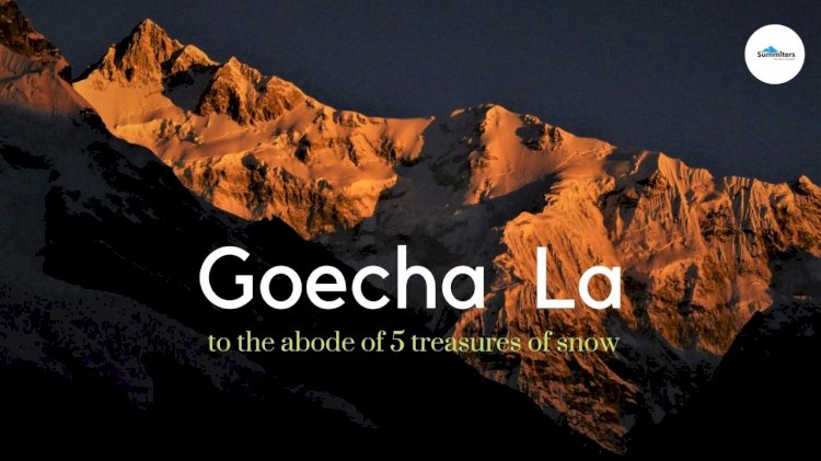
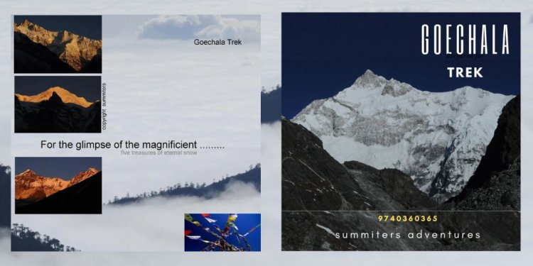
Goecha La : To the Abode of 5 Treasures of Snow
If there is one trek in India that is magnificent and offers everything for an avid nature lover. Then It's none other than Goecha La in Sikkim Himalayas. Here you don’t just see one summit — 3rd highest Mountain Kanchenjunga — but 14 other big summits. Don't you agree that’s a lot for any trek — especially from close quarters during the Goechala trek.No doubt that trekkers will accept Goechala to be the closest to the big mountain treks bordering Nepal. The trail promises brilliant close-up views of the Singalila range, Sunrise, and pristine Samiti Lake, and the trail blessed with Rhododendron forest, endangered red Pandas and more is a visual treat.
I woke up in the early morning to the sound of the clinging of bells of yaks. There is a patter at the door, I came out of the Guesthouse in Yuksom. The owner of the Guesthouse, shivering, and still holding a flask of hot tea was standing at the door. It was still raining and not a good sign. We were staying in Yuksom for 2 days, the weather was absolutely fine when we reached the evening after traveling. from Bagdogra.
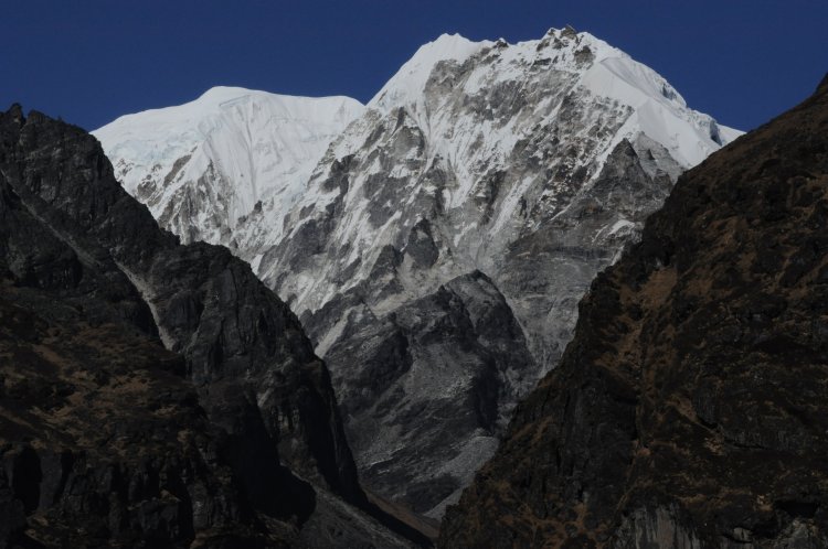
The Goechala trek is one of the more popular treks in the Sikkim region of the Indian Himalayas. The intimidating trek route starts from Yuksom in South Sikkim and goes up 48 km north, along the valley of the Prek River, to the windy Goecha la pass at an altitude of 16,200 feet. From here, one can almost touch Mt Kanchenjunga, the third-highest mountain in the world.
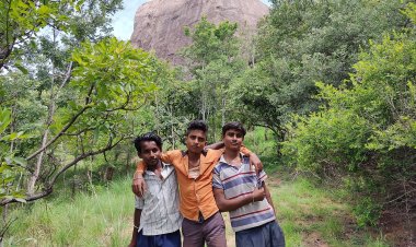
We a group of 4 of us arrived at Yuksom the previous evening in a jeep passing through Jorethang after a serpentine journey. But after a good night's sleep, we are ready for the long haul. Sonu Singh, our guide gets our permits ready and we hit the trail. The sun was peeping out and everyone’s eyes were on the clouds. Mountain weather is unpredictable but when remnants of cyclones hit the Himalayas, the water droplets drip from pine trees, and clouds are engaged for days and the weather thus becomes wet, and gloomy, there is no Sun around
As we climb up, there are wooden, tin roofs, and stone rustic huts, strategically located, which look as if precariously clinging to the cliffs with lush green rolling hills in the background. The pony trail itself embraces the mountain and disappears into Kanchenjunga National Park. To the left of us is the steep valley of the Rathong River. The roaring sounds of water and white foam of the very active river will keep us entertained for the rest of the day. The forest is a mixed forest with giant magnolias, pine, oak, and other trees. But this trail is more famous for the rhododendron trees and in summer, the whole forest is flame-lit with red rhododendron flowers
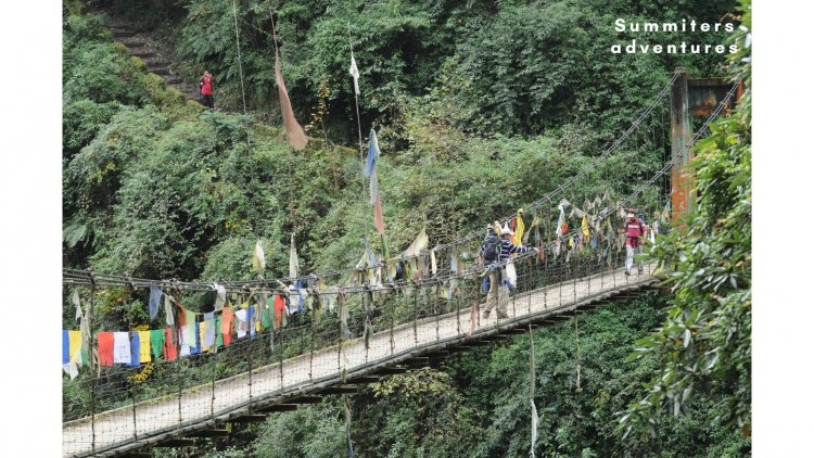
We soon come across a suspension bridge which is one of the tributaries of Rathong River where we meet make way, and greet those heading down The trail goes up steeply from here. Mules and dzos (bred from yaks and cattle) are constantly going up and down the path carrying supplies. After walking along a zig-zag path with a series of ascents and descents along an uphill uneven trail, we reach Sachen at 3:30 pm where we pitch tents. Sachen is a place located, along the ridge. We felt it was the ideal place for a night halt.
Day 2 – Sachen to Tsokha Altitude10,000 ft
The weather is getting better every day but there is no rain and after a quick breakfast, we start for our next destination, Tsokha, which is eight kilometers away and 2,500 feet above. We follow the guide and our rucksacks become heavy day by day We come across another suspension bridge, this time across the Prek River. There is a huge gorge on the river, hearing to call of birds from thickets I move forward.
We walk gently on the swaying suspension bridge, jostling for space, between the passing ponies carrying heavy loads. I stop after a few steps and look down and the river if flowing is 60 feet below I cautiously click a few pictures. Our guide shouts from behind to head fast and to keep a safe distance from mules from then on. As the climb is uphill! We soon reach Bakhim which is the first point in the trail where the views behind us open up. Even though it is fully covered in passing clouds, we can see the valley along which we had trekked to Yuksom. On clear nights, the lights of Darjeeling are visible. We have a bunch of maggi, and some local chang, which is fermented beer made out of red millet. Our cook prepares an omelet egg for chang. Anything warm here tastes great!
After a steep hike amidst rhododendron bushes we reach our campsite at 4 pm, Tsokha, It is said to be the last village of the Bhutia tribe. From now on there are no more villages but just checkposts for trekkers. Tsokha is another clearing on the side of the mountain with great views down the valley. At this height, clouds rise above the valley seeming like waves in the ocean approaching us.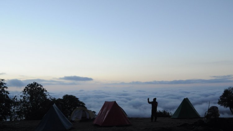
Day 03 Tsoka to Dzongri
There was a heavy downpour in the night, I thought the rain god was merciful until we reached camp. Though it was windy, the cold was tolerable. Morning at 6 am, we could see the whole valley engulfed in mist and clouds rising. We have breakfast in the lunchroom of the adjacent trekker's hut and then hit the trail. Today would be a tough day's trek with a distance of 13 km and a height gain of 3,350 feet. The weather is gloomy and fogged out and chances of clear sky as we go higher and higher. The trail is muddy and the wooden planks on the trail are slippery with rain and dung but we managed to last the day and reach Dzongri at around 3 pm after a short break for lunch at Phedang.
Day 4 – Rest Day at Dzongri
It was pre-decided as an acclimatization day. But we still woke up to get up at 4 am, and after sipping hot black tea We headed toward Dzongri Top which has incredible views of the mountains. We intended to climb up to view point. Despite dense fog and cold, there is dense fog outside we were on the trail.
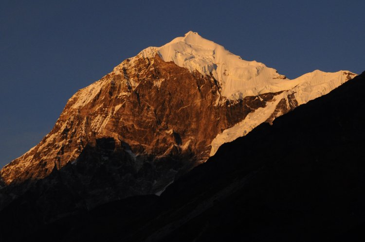
By now other trekking groups have arrived at the top. The first sunrays hit Kanchenjunga. The sight could move poets but we a multitude of ordinary people of different nationalities on the hill moved by the spectacle in front of us exchange mountaineering anecdotes.
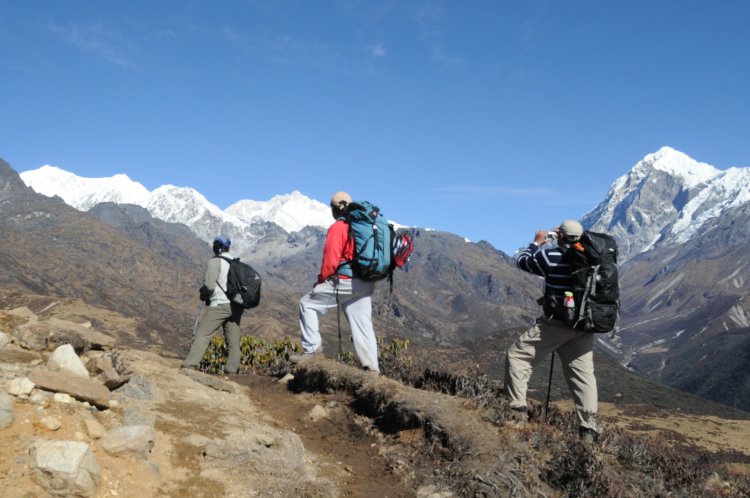
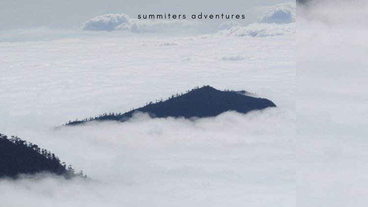
Though it's sunny, the windchill cannot be born the cold and appears despondent. As we leave Dzongri, the clouds and fog play hide and seek again. On a sunny day, it is a beautiful walk across the meadows with snow peaks for company.
The meadows of Dzongri end after a distance and a steep descending trail that reaches Kokchurang at the bottom of the valley comes into view. Our guide points out a Male Red Panda, - Popularly known as Firefox moving on one of the trees.
An endangered species is said to be found only in Singalila National Park. The descent is steep and we follow the guide which leads to the river bank.
It is a killing descent of about 70 degrees more than a kilometer. Our guide, says that we have almost reached and motivates us.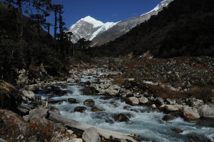
At Kokchurang, we have potatoes and boiled eggs for lunch near to a log hut. Kokchurang is right beside the Prek River and is one of the most idyllic spots on the trek to pitch camp and Mount Kanchenjunga in the backdrop. We could see the best views of Mount Pandim.
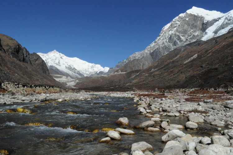
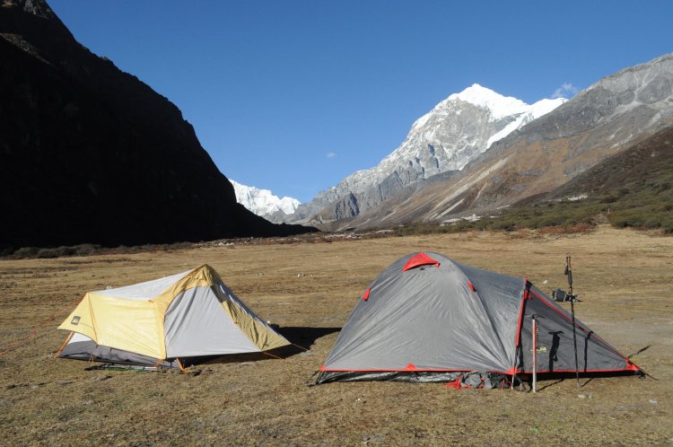
We walk further up the river and by 5 pm reach Thansing. Thansing is a meadow in a valley with marvelous vistas with 18,000-foot-high peaks lining up the valley and the southeast ridge of the Kanchenjunga straight ahead. The vast valley serves as an ideal camping ground, we pitch the tent and go around to explore the valley.
Day 06 Thansing to Lamuney
The day is a relaxed walk, along the valley. It takes 3 hours to reach the Campsite.
Day 07 Lamuney to Goechala. Back to Thangsing Camsite
The D-day arrives. The time is 13:30 Midnight. We are served black tea and porridge for breakfast. Today we will carry our backpacks but our multiple layers of clothing make up for the weight. It is an exceptionally clear and star-studded sky. The snow peaks are glittering in the moonlight. We cross multiple brooks over frozen wooden logs being careful not to slip over the ice on the logs. There is frost everywhere and the temperature is sub-zero and wind chill. We trudge carefully in the darkness, passing through Samiti Lake. After an uphill climb through moraine and scree, It is 4:30 am. We are on time. We crane our necks towards the rocky wall to get our first clear views of Mt Kanchenjunga and the Kabru peaks. It is 5:10 am and we should have reached the first viewpoint by now.
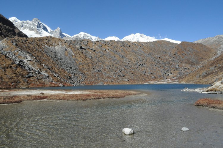
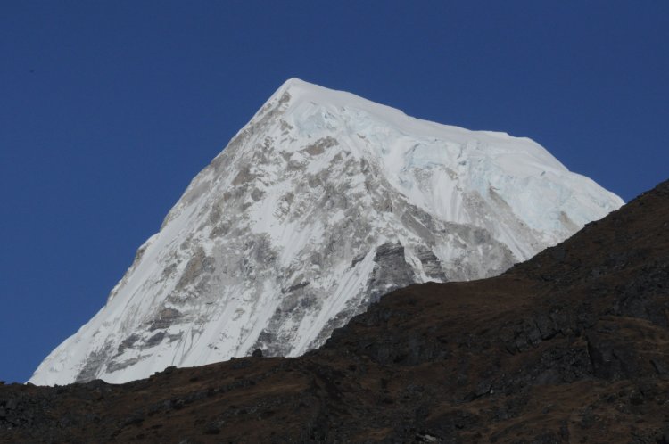
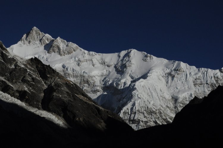
There is a depression after the moraine wall which plays host to a snowmelt-fed lake. This is crystal pristine Samiti Lake. We walked around the lake and took a few pictures, which is nearly 600 - 800 meters in length, and reached another moraine wall. We were now exactly in the bottom of Mt Pandim which towers over us like a king at 22,300 feet
By now we felt a bit warm walking up. We climb the moraine, which is a scramble over rocks over a steep ascent. Over the entire trip, we were fortunate that none of us were affected by high-altitude sickness. I could notice stars still shimmering in the blue sky.
After an hour of trekking on rocks, I climb the ridge of the moraine wall. This is where the Kanchenjunga ridge again opens up for viewing. The Rathong and Zemathang glaciers are visible on the left of the ridge. It is exhilarating. After a few more minutes, the first viewpoint comes into the picture. It is nearing 5:15 am am. We are now at around 15,600 feet and Kanchenjunga can be practically touched from here.
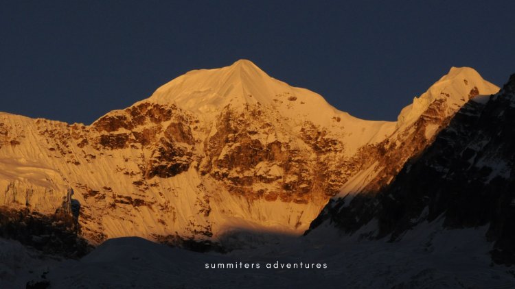
We reached the vantage point and waited patiently for the warmth of the sun. The rays of the sun-kissed Mount Kanchenjunga first 5:30 am and spread across the valley slowly. At 14,500 feet the body is shivering. The yellow light slowly turns brick red and glows brightening the valley.
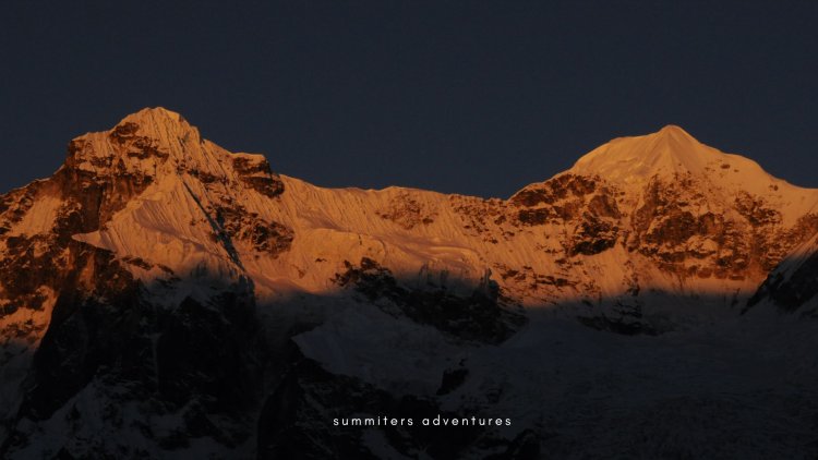
A memorable indeed, all are dumbfounded. I am finding it difficult to click the photos because of the wind chill. A few members still gasping to breathe reach late. The divine light ends in a few minutes. Our guide and German solo trekker motivated me to cross the Zemathang valley and reach View Point 2 which is further up high and takes more than an hour. I shake hands with them and walk further.
The path to Goecha Pass is a trail that goes down and climbs up another ridge and comes up to the right of Goecha Peak which is in front of us. But there is a mixture of snow and boulders all over and there are no visible footprints towards the pass. No one has attempted it over the past few days. Our guide goes down to check the route and comes and makes a sign to follow him. I smile and follow him agreeing because walking on the ridge further though tough, i am willing to do it.
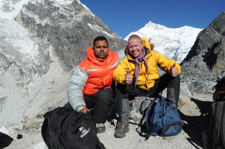
Exactly at 7 am, we reach View Point which is located very close to the Kanchenjunga separated by a glacier. I feel hot by the scorching heat of the sun, as I am wearing down. It seems as if I am touching Peak. I can't express my joy.
The view from the Goecha pass is just not the Kanchenjunga and its southeast ridge but of the Talung glacier below and the Zemu Gap, another pass that leads to the Green Lakes area of Sikkim.
The German friend expresses his desire to go further to view point 3 which is to right. I say ok to it. But my guide disagrees with it and says NO. It is restricted for visitors, because of security issues.
Though we have energy and interest. We retreat after posing for the camera.
Upon return, we stopped near the samiti lake, we sight, we saw Himalayan Blue Sheep grazing on the slopes in the distance the sharp crackling sound of boulders somewhere in the valley could be heard. Through the walkie-talkie, I shared my joy with other members and staff who made it possible, who had already reached Thangsing.
Day 08 Trek to Thangsing
By the time we reached Thansing, it was afternoon. We have walked 23 km since midnight. We were served hot pakoras and black tea. We slide into sleeping bags early after a long day.
Day 09 Tsokha to Yuksom
Trekking companies, usually mention that the trek is moderate. But this trek is above all and exceeds expectations. The descent is killing us, we had to walk down 3,500 feet over 20 km last day. We reach Kokchurang and then take a new route along the Prek River through the forest. I look curiously for Red pandas, as a guide too eagerly looking for it.
By the time we reach Tsokha, it is evening At 5.00 pm, it's cold and dark. We opted to have Chi, a traditional drink made of millet grains of Lepchas of Sikkim with staff as a moment to celebrate.
We hear news from the yak man that it's heavily snowing up in the mountains.I peep through the glass window and slide in cozily into the blanket.
If you are impressed with the blog and want to undertake a journey as we did, in the lap of Kanchenjunga Massif. Then be free to call/ WhatsApp 9740360365 or write to us to plan a hike for you Do contact us
Summitersadventures@gmail.com