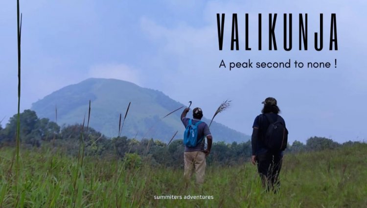
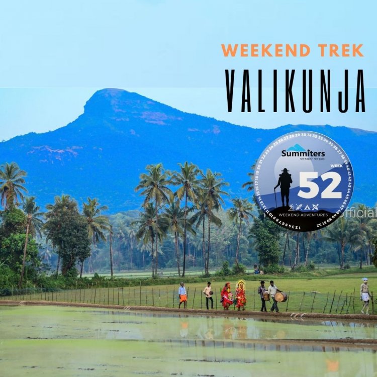
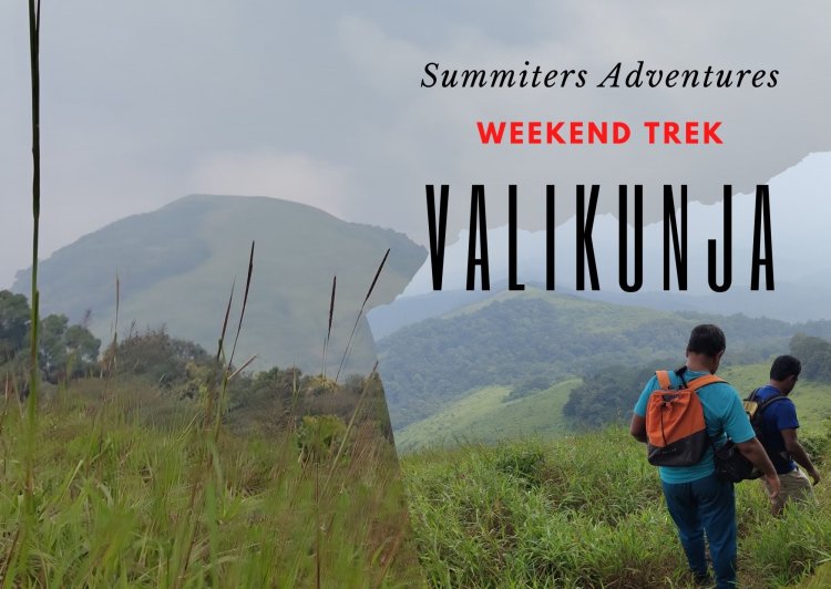
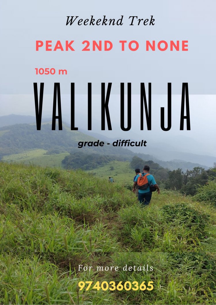
Valikunja - A Peak second to none.
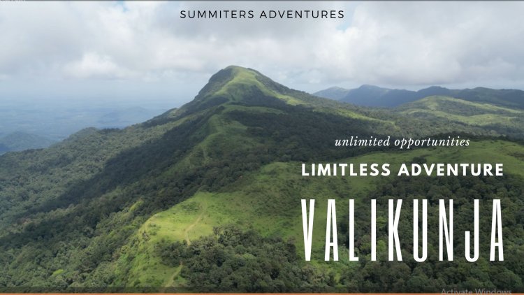
Kuduremukha National Park known for its biodiversity, comprises innumerable species of flora and fauna, grasslands, montane forests, perenniel rivers. The forest ranges here rise and embrace the hills.The challenging evergreen hills pose challenge to the adventure seekers.A new addition for those awaiting adventure is less known Valikunja peak.Snugly perched at a height of 1089 metres, this hill is a store house of surprises.Though less known, it is something no less charming than others !
Though the elusive peak Valikunja did not have any prominent historical significance but still was close to my heart. During my travails, having done all the prominent peaks in the Park namely Gangadi Kallu, Ajjigudda, Netravati Peak, Kalsanka, Kumbala Khana, Attiberi, Manikaya Betta, and Kurinji Kallu was a sense of achievement.
The sheer remoteness, location, and biodiversity of Valikunja or Ajjikunja have always been alluring and haunting me for more than 2 decades to visit the paradise. Overshadowed by popular Kuduremukha and Netravathi Peaks, being aloof, not much was known about it until I discovered it recently.
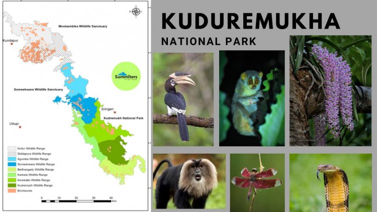
However, Kudremukha wildlife division has two sub-divisions, namely, Kuduremukha and Siddapura wildlife sub-divisions, and consists of nine ranges, namely,
Agumbe, Amasebailu, Belthangadi, Hebri, Karkala, Kerekatte, Kollur,
Kudremukh and Someshwara wildlife ranges.
Kuduremukha National Park is located at the tri-junction of Dakshina Kannada, Udupi District, and, Chikamagaluru district of Karnataka.
The Western Ghats is one of the thirty- four hotspots identified for biodiversity conservation in the world
&
World Heritage Site too
We passed through the serpentine ghat road en route Samse and S K border it did not take much time, to avail permits from the Kerekatte forest division office to gain entry. We were accompanied by a forest guide and we hit the trail one fine misty morning. The post-monsoon rains had created havoc, we traveled by jeep for about 5 km and started our trek through the forest.
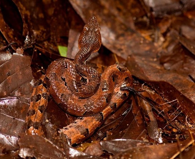
Though it was a bit humid, we smeared a mixture of snuff to keep leeches at bay. We walked through the Jeep track , with nonstop music of beetles and cicadas for company. The whole region is home to King Cobras, and Hornbills and we could hear to the chattering sound of a few primates in the thickets.
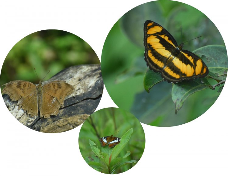
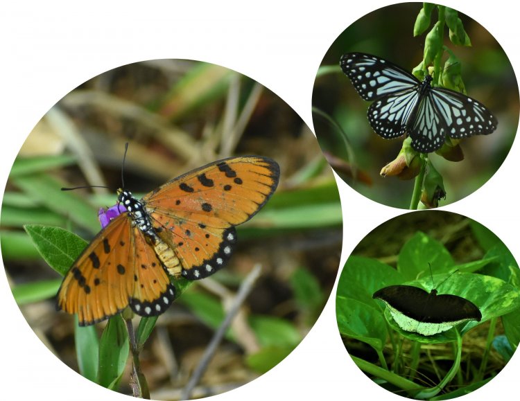
I could catch a glimpse of a Glassy tiger, fluttering with its mate. In spite of the harsh light, we stopped at every bend to capture a new species. The Tawny Coster, Commander, Grey Count, Chocolate Pansy, Common Lascar, Blue tiger, Blue admiral, Southern Birdwing, Paris Peacock, Painted sawtooth, Malabar banded Peacock, Common jezbel, Tawny Rajah, Common rose, Orange tp, and blue oak leaf species drew my attention.
I remember sighting similar species during my visit to Netravathi Peak too..
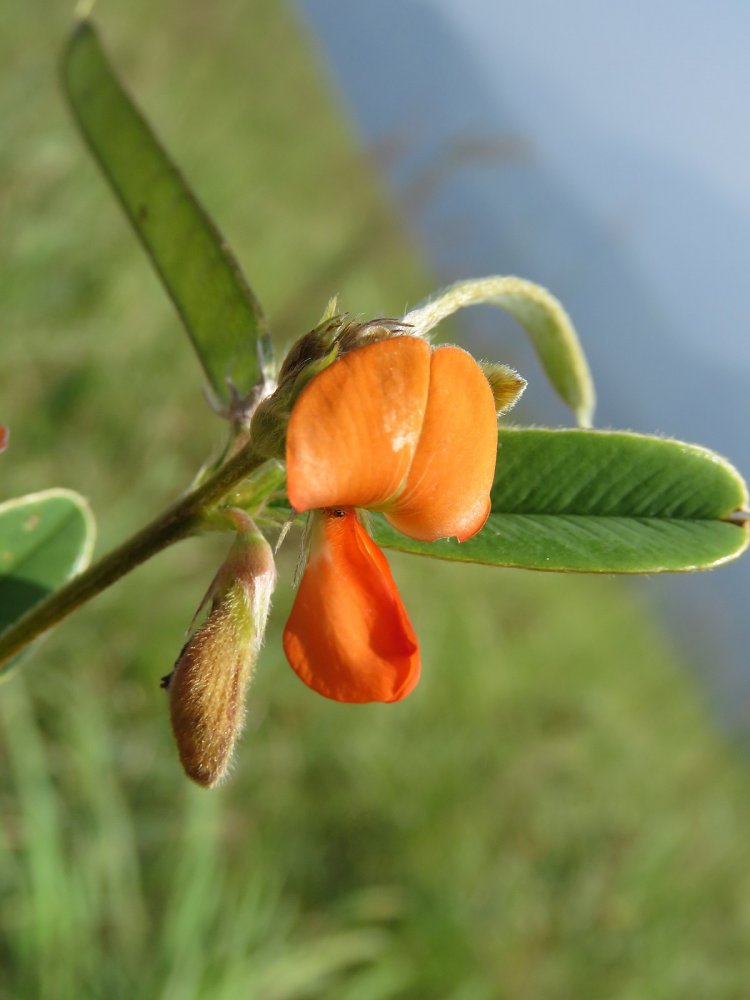
A perenniel unsersgrub known as Orange Teprosia found in the western ghats. In the local dialect, it is known as Batteharaku gida and is prominently visible from a distance by its striking color. commonly known as “Sarapunkha” in Sanskrit, and is widely used in Ayurveda and Siddha medicines to treat various disorders like jaundice, and kidney disorders and to reduce thirst in diabetes mellitus
Climbing the grassy slope, in two stages was a bit demanding. With no shade, and no water !. Everyone was parched out because of the heat. Finally when the sun was above us, made it to the summit. We bowed to the rocky footprints in devotion and as a mark of respect. As I raised my neck, I suddenly noticed a sambar deer, leaping and making its way in grassyslopes.
It is said that locals called it Ajjikunja Peak, and believe that lord Parashurama threw his axe to sea and that footprints are of great sage. The view of the hills during descent was tiring, the play of light on the hills and cloud movement was mesmerizing.

After reaching the base I turned back, walking through the fields to get a final glimpse of Valikunja, Did we really go so high and summit, we asked ourselves to justify?
I finally felt that a satisfied life is better than a successful life because our success is measured by others, whereas our satisfaction is measured by our own
Soul, Mind & Heart
Adventure Souls willing to trek to Valikunja Peak
Altitude - (1 089m/3 573ft a.s.l.)
Get to know a few things before HEADING to peak
1. Where is Valikunja Peak?
It is located border of Karkala and Chikmagalur districts on the SK border @ Kerekatte
2. How to reach kerekatte?
The best way to reach the Kerekatte Forest office is through Samse, which is located 50 km away on Kuduremukha Road.
3. Where to stay during Trek?
Samse is the ideal place to stay. As no accommodation is available in Kerekatte
4. Where does Valikunja Trek start and End?
Kerekatte Forest Check post
5. Trek type and difficulty level
A stretch through the initial jeep track in the reserve forest, Shola, and grasslands. Long trek exposed to sun and difficulty level Moderate +
6. Do I get leeches during the trek?
Yes. During monsoons sure. During the dry season, you will not find them.
7. How far is Valikunja from Kerekatte ?
20 km to and fro. However, we will arrange a pickup to and fro from Kerekatte up to 3- 4 km up and down to save time.
8. Do we need permission from the forest department to visit Valikunja?
Yes, permission is needed and guards have to be informed in advance. Please carry the printout of Aadhar/similar and sign the disclaimer form before you start the trek
9. Trek start time and End Time
Make sure you finish formalities and begin the trek by 8 am from the checkpost and return before 5 pm.
10. Do we get guides to guide us for Trek?
Yes, registered forest guides escort you on the trek. For every 10 members 1 guide is mandatory.
11. Is the network available on the trail?
It's a forest area, BSNL / Airtel / Vodafone / Jio / No network available.
12. What is an entry fee and guide fee?
The entry fee and trek fee is Rs 500/- per person and the Guide fee is Rs 1000/- for 10 members.
13. Where to book tickets ?
Few Dos and Don'ts for you to abide by strictly!
1. Never ever venture during monsoons
2. Forest permits are mandatory
3. Go with registered guides
4. Carry sufficient water minimum 2 litres and trail food
5. Dont visit the place during the Summer season
6. Carry trash back and please don't discard
7. Leave hills as they are. don't contribute anything
If you are planning to visit this piece of paradise. Do let us know of any arrangements. We will be happy to assist and arrange it