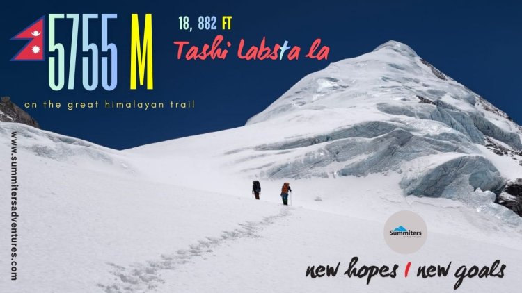
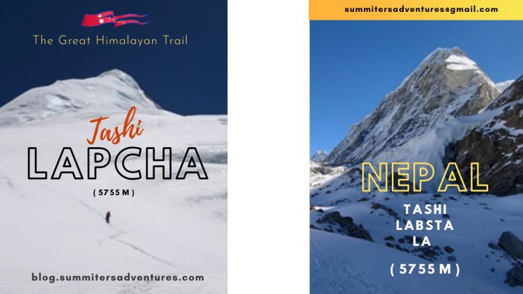
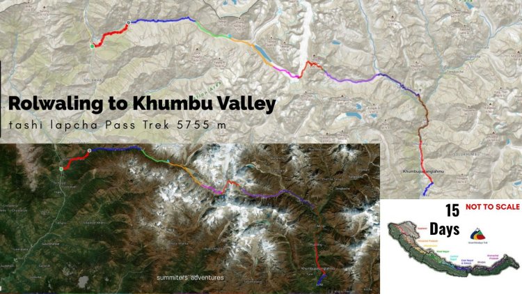
Tashi Labsta La Trek - On the Great Himalayan Trail
Mountain country Nepal is known for highest mountains and Passes of the world.The Solo Khumbu valley is known for 8000 m peaks, they pose a challenge to mountaineers. The verdant valleys with high passes fall in the Great Himalayan Trail are equally fascinating with grand views and test endurance of adventure seekers. Among them Tashi Lapcha pass or Tashi Labsta Pass 5755 located in Rolwaling Himal and pass over to Khumbu valley is a trekking delight. The classic route is a storehouse of surprises for nature lovers. Avian haven for birders and with breathtaking scenery ! A most demanding and remote high-altitude trek in Nepal, ideal for experienced trekkers looking for a true Himalayan wilderness, enriched with a taste of raw adventure.Here is a soulful experience of a trio who successfully completed it inspite of all turmoil with grit & determination !
Then the mountain changed… and I stayed.
Same place. Same mountain.
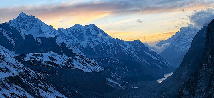
One mountain has different moods in one single day.
It woke up soft and pink.
Turned golden under the sun
After watching her transform minute by minute, I got it.
I felt that some places aren’t meant to be captured…
They’re meant to be witnessed.
The call for mountain was within !
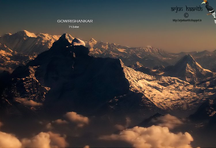
In Tibetan dialect all sacred - Jomo Tseringma ; The twin peaks Lord Shankara and his consort Gauri - Gaurishankar - Altitude (7,134–7,181m).The name comes from Sanskrit who are said to be inseparable denoting the sacred regard to which it is afforded by the people of Tibet and Nepal.
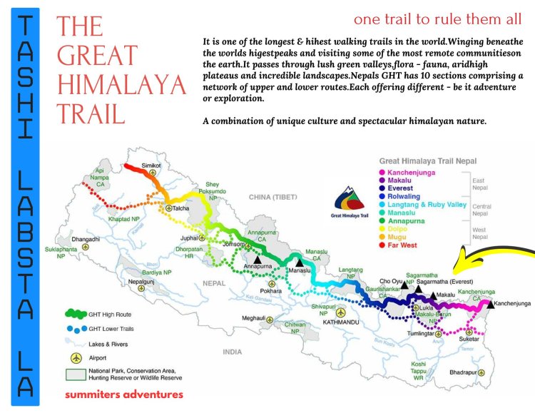
On the Great Himalayan Trail
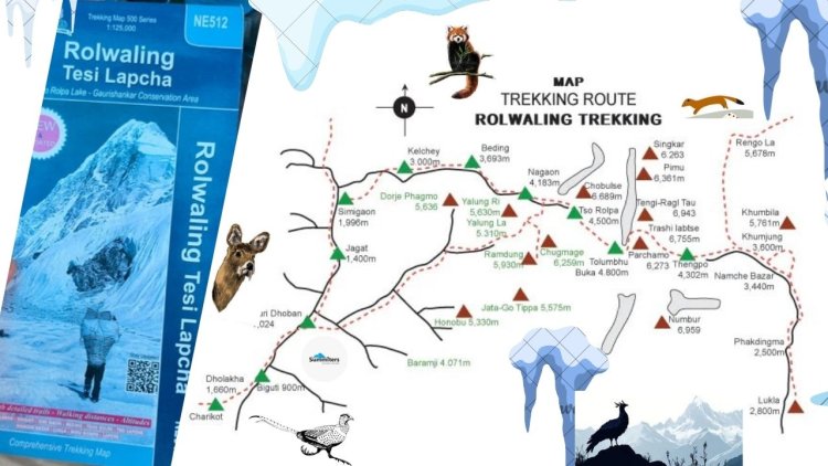
The Tashi Labtsa Pass – also spelled as "Trashi Labtsa" on older maps – connects the Rolwaling Valley in the west with the Khumbu region in the east. Crossing this pass 5755 M is considered one of the most difficult and dangerous treks in the region. The pass is usually crossed from west to east, from the Rolwaling Chhu Valley in the Rolwaling Himal, over the pass, and into the Thame Khola Valley in the western Khumbu region.
Journey begins
After procuring permits to enter Gowrishankar Conservation Area & Sagaramatha National Park we started our journey along with our 4 HAPS ( HIgh altitude sherpa friends ) & a guide Chirring Sherpa hailing from Okladunga in Solo Khumbu region who had visited this valley couple of years back.
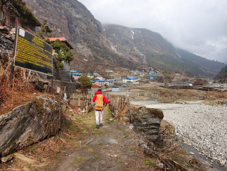
We passed through Nagarkot - Singati - Charikot and after a 6 hour journey we reached the sleepy hamlet Chyot Chyot by evening.Basic amenities was luxury here, we spent a night here. Chet Chet is the last roadhead and starting point of trek.
01 Trek Day - Chyot Chyot - Kyalche Via Simigaon
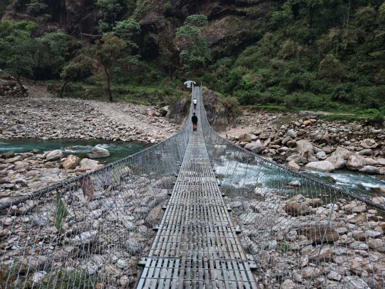
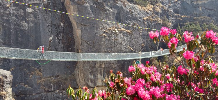
We started our journey next morning carrying our hefty rucksacks towards Kyalche Village. After crossing a hanging bridge over Tama Koshi river we started a steep ascent to Simigaon located along the mountain ridge,overlooking the valley.
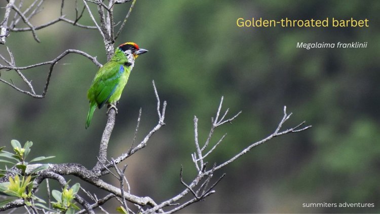
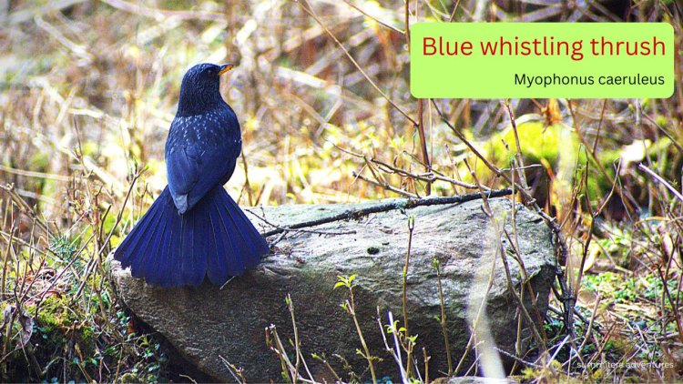
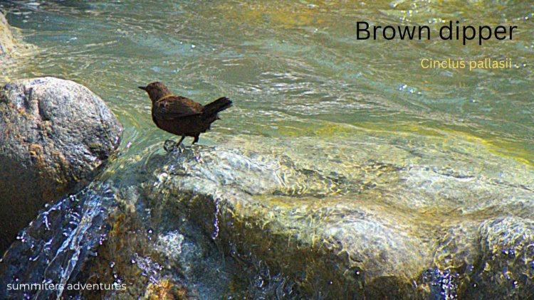
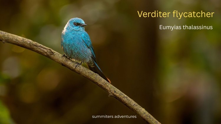
The forest trail was in riot of colours with Rhododentron blooms- Red - Pink and White and live orchestra with teeming avian life.The non stoppiing call of Golden throated barbet drew my attention,Blue Whistling thrush, Brown dipper seemed busy unmindul of our presence busy in turbulent water,The colourful bluish Veriditer Flycatcher was restless and was busy in a brunch !
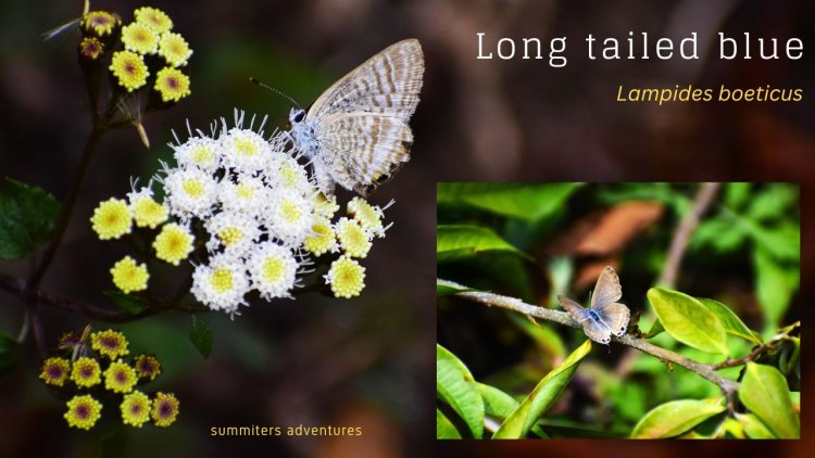
The butterflies were no less attractive,busy in mud puddling and feeding on nectar.The Painted lady was common sight , Long painted blue resting on flower sucking nectar
The grand himalayan trail was power packed with suprises and engaged us during the day.By the time we reached Kyalche located at 2825 m it was evening
 The lodge located at a idyllic location was cosy to host us and retire for night after a tedious walk.The night was cold !
In the morning we were greeted by snowclad peaks and Gaurishankar rising above dominating the valley.We walked parallel to the stream, carpet of flowers, bushes and birch forest !
02 Trek Day - Kyalche to Beding Village
After bidding farewell to the host we started our journey around 7 am considering a long day.The swift flowing river was in tune with us.Negotiating the landslides and forest cover we walked till evening.The path greeted us with a carpet of flowers.The whole trail seemed like a haven for nature lovers with wildlife and birdlife.
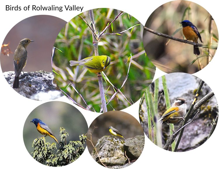
The Whie tailed Redstart, White browed fulvetta, Whistlers Warbler, Blue fronted Redstart,Black and Orange naped flycatcher, Snow Pigeon, Rufous bellied Niltava, Brown rock pipit, Black and Orange Flycatcher and Grey wagtail were a greet to eyes.
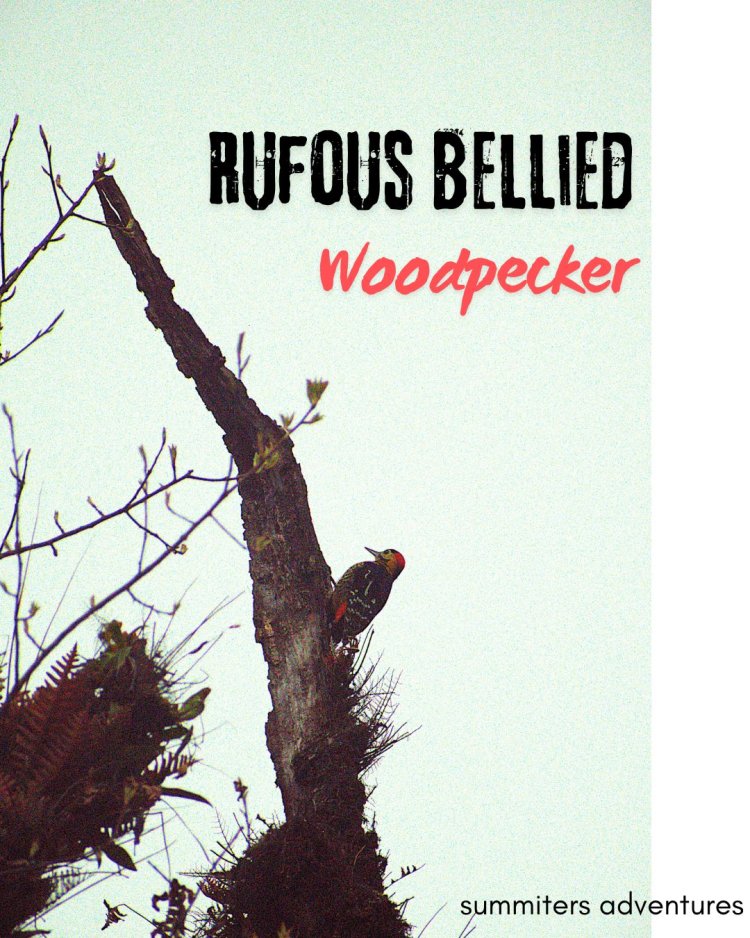 I could hear the chattering calls of Rufous bellied Woodpecker, as i craned my neck to locate it seemd to be perched high on the tree and hear the rat-a-tat sound of woodpeckers drumming.The cold gripped us as the sun disappered behind the mountains.
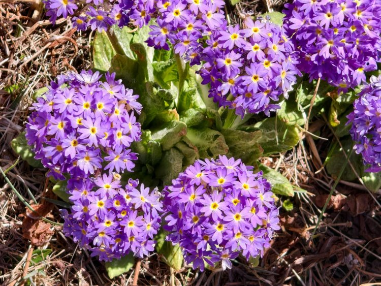
The shimmering alpine flower drumstick primrose drew my attention and frowned at me and motivated to walk until in reach my destination.
The arrival of abandoned structures indicated habitation.We walked past the hanging bridge until we reached the destination.
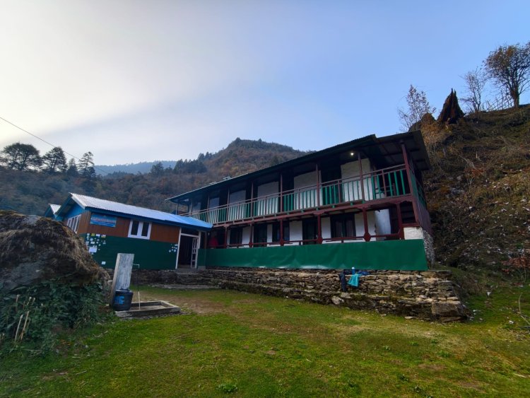
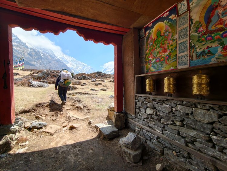
A place where nature, culture, and compassion live in harmony
 In the cold evening,the host were eager to receive with a hot lemon ginger tea.The dining area was a cosy place to interact with fellowmates.We were the only guest and other nepali for a discussion.
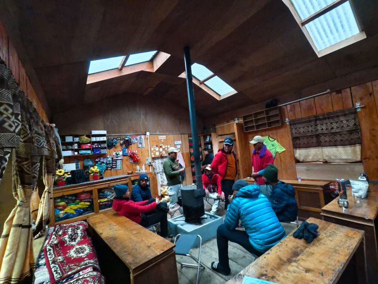
As sun moved away from valley,we became busy in the dining area and hesistant to move around.
03 Trek Day - Beding to Na Village Altitude 4190 M
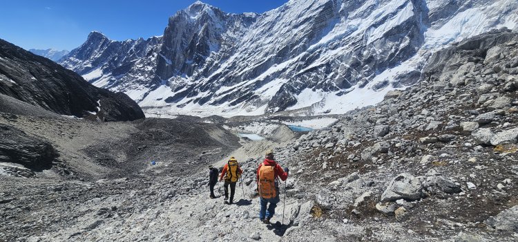
It had become a routine for us to start early as sun kissed the valley and neigbouring peaks in horizon.The distance to Naa village was day long 10 -12 hours of walk through the valleys.
The apppearance of Juniper scrub indicated us of high altitude.As usual the landscape greeted us in every way.The village was set at a picturesque location, adjoining to the turbulent river, guarded by the snow clad peaks and over looking mountain peaks
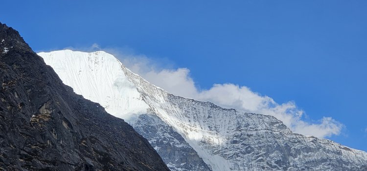
Rolwaling Chhu valley looking east towards Choburtse / Tsoboje (6686 m)
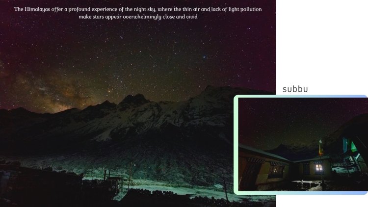
We had decided to make Na village base and acclimitize 2 nights staying here, before venturing to higher altiude. It thundered and snowed for few hours and sky became clearer in the night.Our team member Subbu was deteremined to capture the star trails and successful in recording in the midnight.The temperature was around -19 degrees and he mentioned that it was worth waiting & experiencing it. Kudos to his effort !
04 Day Acclamitization Day Na Gaun Village 4180 m
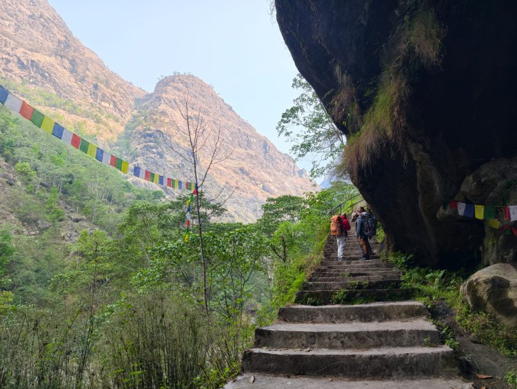
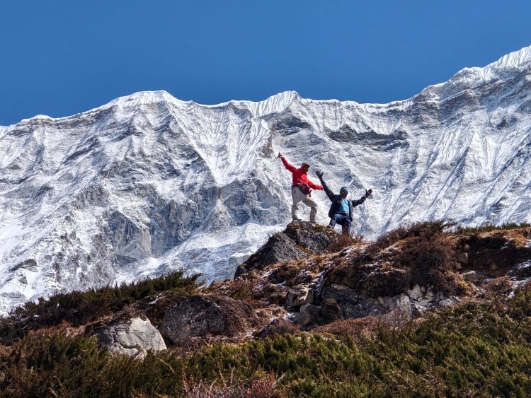
After feeding the soul,we decided to go along with our guide for a height gain, a accamitization walk.The sunny day was perfect to explore the environs.We chose a hillock 400 metres heigh above Na village.
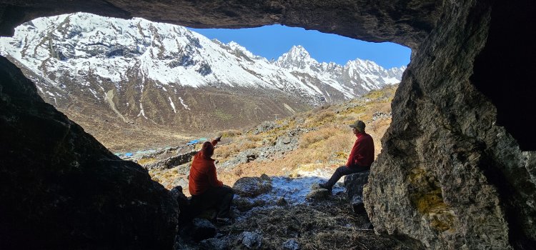
We explored a cave underneath it and got a glimpse of high mountains guarding the valley.There is a cave in the cliffs where Guru Padmasambhava is said to be meditated, Vajra Kyliya and attained Maha Siddi !
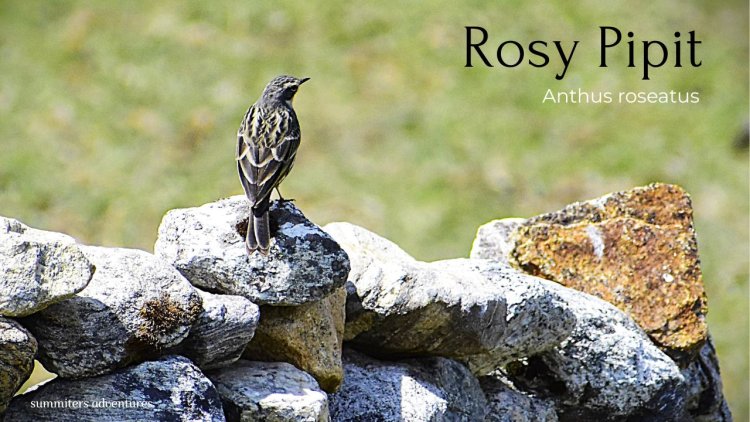
The village had a 360 degree view of mountains , and was known for Yak herdsmen.We explored the river banks in search of native birds.I could spot few pigeons foraging on insects after melting of snow.I could spot Plain mountain finch, Rosy Pipit and flock of Snow Pigeon ....
I was acompanied by team mates Subbu and Ajay, suddenly subbu spotted a mammal sprinting on the otherside of river bank about 20 ft away on rocks.It soon disappered into the rocky outcrops. Later we came to know that it was a Solitary creature Mountain weasel....
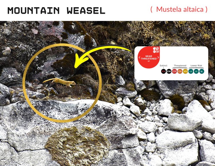
The species Mountain Weasel was identified based on its uniform yellowish-brown coat, the presence of a black mask that surrounded its eyes and the white chin, which are key characteristics that distinguishes it from other weasel species. This is the first confirmation of the presence of Mountain Weasel in Gaurishankar Conservation Area, Nepal in 2019
The rich bio diversity Gaurishankar National park is a power house for those who want to explore and for photography entusiasts.I did justice with my 70-300 lens by maintianing a distance from the subject without disturbing them.
I felt that their was a climate change, their was thunder followed by lightning in the night.A snowfall occured as expected.The morning was clear with sun kissed vally.
05 Day Na Village to Kyatang 4700 M adjacent to Trakarding Glacier
We head towards east, after crossing the metal bridge, at a Y juction a valley below Tsoboje Peak ( 6686 m ) Peak, led on the lateral moraine to moraine of the Ripimo Shar glacier.
Through the Maps i understood that it leads to a high altitude lake known as Doodh Kund located below peak Kang Nachugo 6767 M , Gaurishankar 7135 and Mount Chekigo 6257
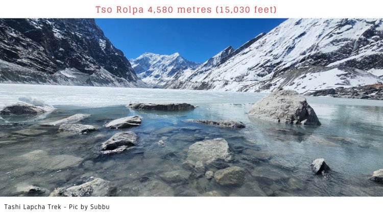
We followed the route as decided, a steep climb round the mountain path in the shadow of Tsoboje peak we reached Tso Rolpa Lake located at an altitude of 4580 m.
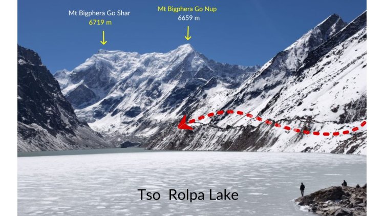
The frozen lake and lake water shimmmered in the bright sunlight.Mount Bigphera Go nup 6659 m and Mount Bigphera Shar 6719 m towering above R - L the lake and Trakarding glacier got mirropred in the lake.The chill wind and scorching sun, long journey over moraine did not allow us to explore the environs for more than 45 minutes !.
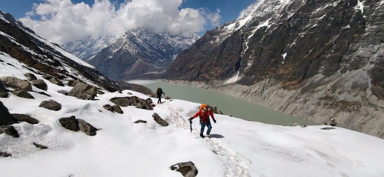
A path past lateral moraine led us through grassy patch and later a winding path moving towards snout of Glacier.We negotiated through the moraine,snow slopes and tricky land slide path.Traversing the icy path path with crampons. We could get a glimpse of tongue of clacier and birds view of lake and mountains in the backdrop.The 60 to 70 degree slope was slippery because of melting of snow and at some places a small mistake seemed to be a severe injury or FATAL accident indeed !.
A balanced move, Climbing with 14 kg rucksacks was a tedious task and all worth the climb.
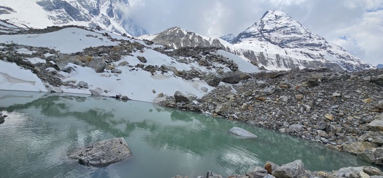
We finally reached Kytang located at 4700 m heart of Trakarding glacier. The mountains seemed closer and journey aftermath seemed challenging on moraine ! Bhim Tamang one of our Nepal staff mentioned that he had visited glacier about a decade a back and glacier had retreated massively in the past years.
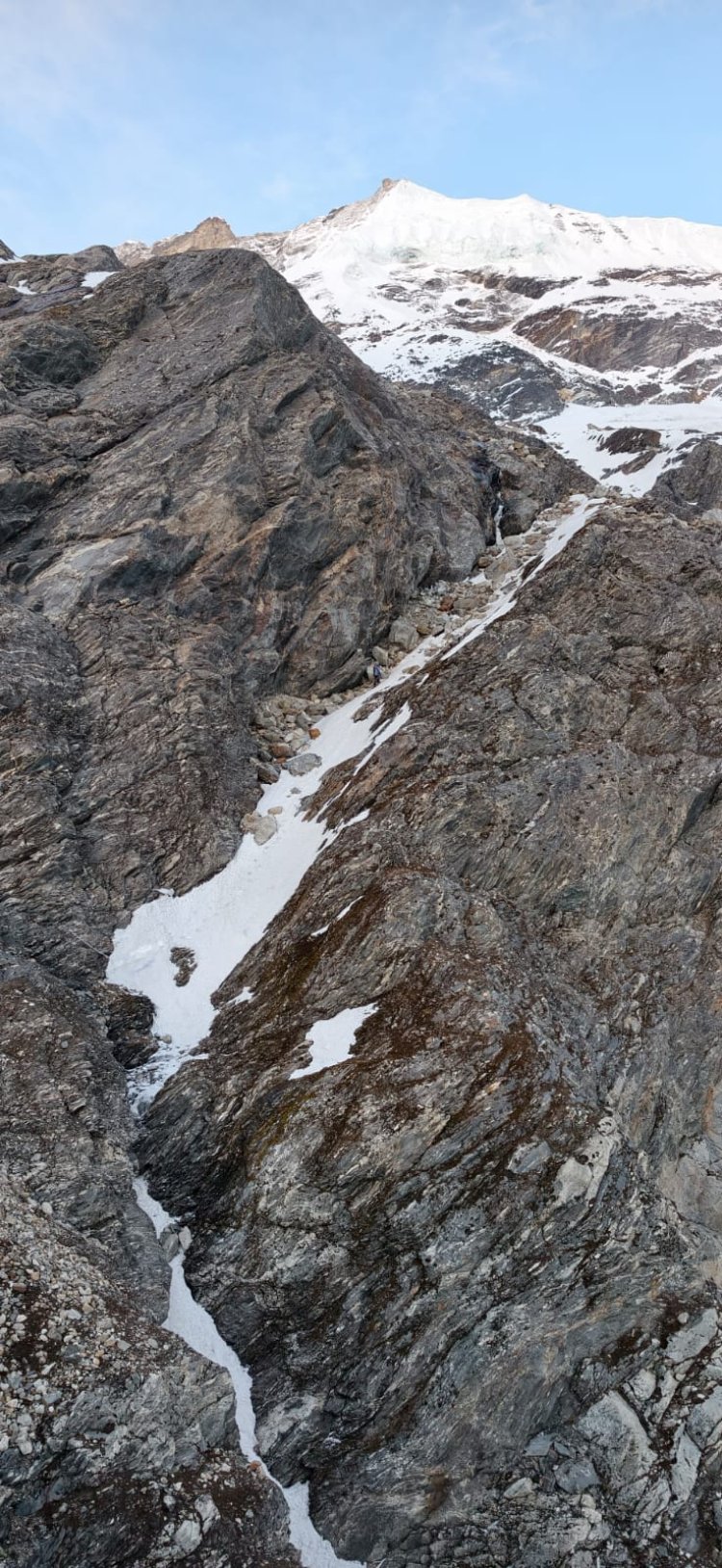
06 Day - Kytang to Drolambau Glacier Campsite 5050 m
The weather seemed favourable with clear sky. Since it was long day we carried pack lunch and negotiated the glacier.The moraine path was too unstable with lot of deviations.It almost took 8 hours to successfully cross the glacial path.
Our guide chirring sherpa, mentioned that new route had to be deciphered as earlier path had washed way due to a avalanche.
It was already 3 pm and weather been to worsen at any point of time.He took the path leading to glacier upward, we followed him.It was literally a 50 - 60 degree climb on unknown path.It sharted snowing and visibilty was very poor.
I could see SERACS, 80 -100 feet high hanging from the mountain. Standing below seemed a nightmare. Our HAP Rongdu Sherpa and guide had spotted the camping place and was descent was in opposite parallel path. Members were feared of Hypothermia because of inclement weather and snow fall.
We followed the guide, a descent through a Chute filled with ice and snow almost 70 degree. Negotialling the scree, boulder ridden path, and water flow from mountain streams. A small slide or fall might was dangerous.We reached the campsite at dusk and all were dog tired after walking for nearly 12 hours.
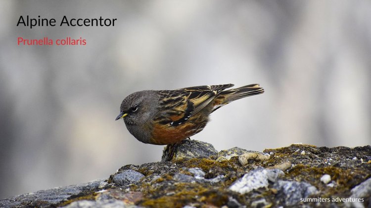
A flock of Alpine Accentors greeted us with their calls, often spotted in the rugged,high-altitude terrain of the Rolwaling Valley in Nepal.They looked very bold. Above the tree line, these active foragers can be seen hopping among boulders, foraging for insects, seeds, and berries in the alpine scrub.
It was too cold and i could catch a glimpse of the glacier and the path we had taken ,Tso Rolpa glowing silver and western sky in myriad of colours. A sense of achivement, lingered. We were served hot soup.Soon we were in the warm sleeping bags.
The night sky was star lit and was cold. We could see the snowclad peaks in the horizon.After a discussion we decided to start early next morning 3 am with an intension of reaching Tashipukh High camp by noon.
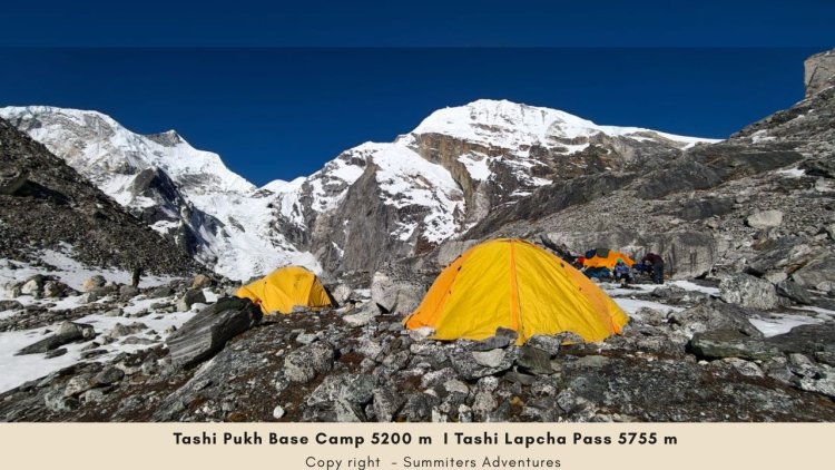
07 Day - Tashi Puk Base Camp 5200 m
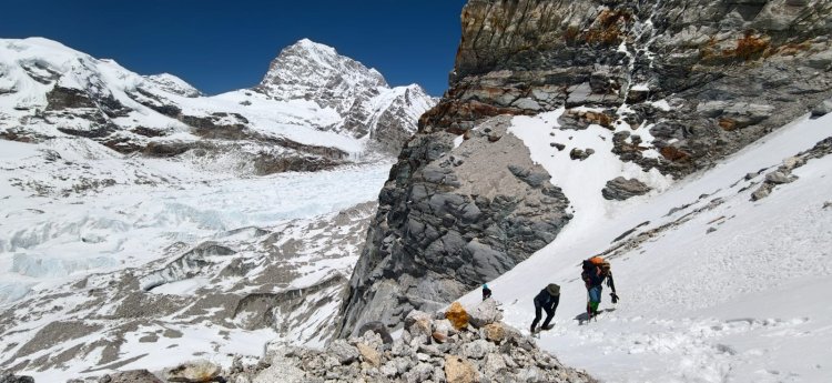
We all woke designated till, it was too windy and windchill -18 degree. No one dared to go out. We had Tsampa - (Tibetan roasted barley flour), mixed with hot Tibetan butter tea (po cha) and a bit of butter / ghee in a bowl and eaten as porridge for breakfast armed with pack lunch for trail. Our guide had fixed ropes on coulior leading to mountain top.It was a boulder zone packed with snow.
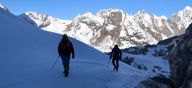
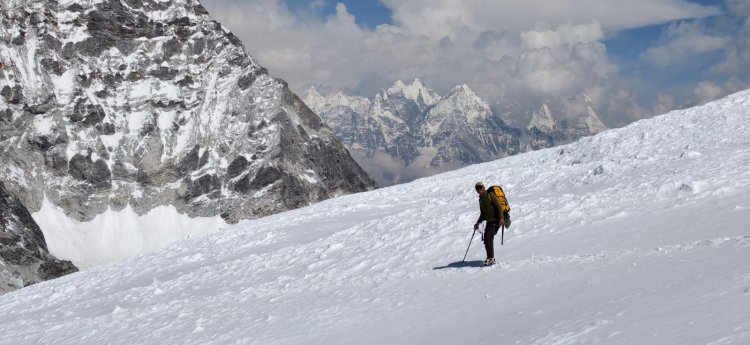
Previous day we had accessed it and slope seemed to be 60 -70 degree gradient.It seemed impossible to start on stipulated time because of harsh roaring wind. Climbing with crampons was compulsary because of blue ice. At 6 am we made wise decision to start, jummared up one by one with heavy rucksacks and reached the top.
The boulder path led to snow field, with the rising sun we started sinking in the melting snow.The harsh UV rays penetrating and reflecting light on snow was unberable !
It was a crevasse ridden path upto Tengi Ragi Tau (6938 m) peak on the eastern edge of Drolambau glacier
Before reaching the Tengi Ragi Tau, the Tashi Labsta pass glacier descends from the right.
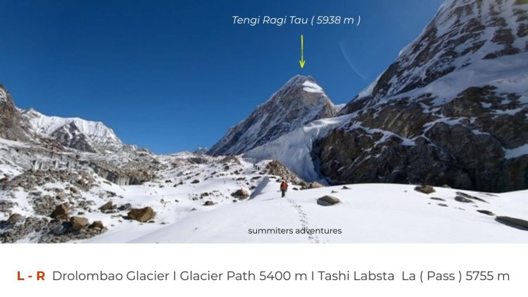
Before the lateral moraine of the Drolambau Glacier, it turns 90 degrees south
and continues flowing in the erosion valley between the base of the slope and the moraine, parallel to the Drolambao Glacier, where it terminates at an altitude of approximately 5400 m. From this point onward, the ascent is made on the ice of the pass glacier.
It as exhausting during mid day with scorching heat. Chirring sherpa had fixed ropes to climb on and gain access to the snow field.
One step ; One breath, followed by hydrating ourselves with electrolytes and walk on the snow field and climb on upto pass in the shadow of Pachermo Peak 6187 m glittering in sunlight. I found difficult to remove goggles and click the photo, as the UV rays penetrating with bright light made us swoon sometimes. Peak climb was not in our agenda and it was a day extra involving a climb above another 500 m from Tashi Lapche pass 5755 ridge.
( Located in the Rolwaling Himal region, it is frequently climbed in conjunction with the challenging Tashi Lapcha Pass and offers stunning panoramic views of the surrounding Everest )
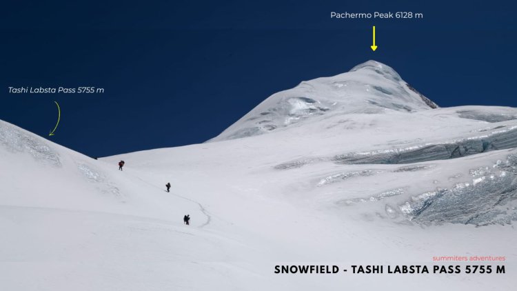
A zig zag path on the snow field and an hour of steep climb led us to the pass.The passge located between Tengi Ragi Tau and Pachermo seperating Khumbu and Rolwaling Valley.
All members and staff reached the pass by 1:30 afternoon .The sky was clear with views of peaks in the adjoing valleys.We thanked the team and Lord Gaurishankar for being merciful and letting to fulfil our dreams.
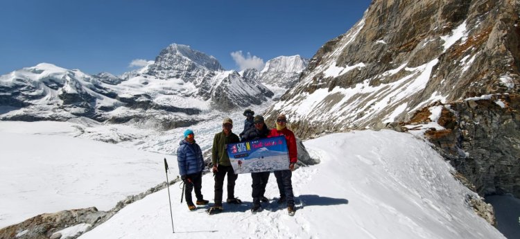
It was windy and forseeing the weather turn bad we posed on the TASHI LABSTA / TASHI LAPCHA / LAPCHE PASS 5755 m and bid farewell to the place with heavy heart !
The descent was gradual intitally and steep as we traversed down the valley.We could see peaks in the Khumbu valley rising above the horizon.
The descent was through moraine and hard ice.After descending for more than 4 hours we were able locate a campsite suitable to pitch tents and water.Few members were dehydated.We had to descend slowly and manaouver the steep slopes 60 -70- degree slopes by shoulder rapelling and abseiling.
At some patches we had to roll down the rucksacks with help of ropes and other gear to approach camp as it was getting dark.The hidden crevesses were posing danger all times.
We pitched the pitched over a snow patched and wind blowing htrough the valley kept us cold all times.The whole vally was surrounded by high peaks Pachermo, Tangi Rengi tau and other unknown peaks.
08 Day - Thame Village
The descent from here passed trhough the bolder zone, with views of Pachermo, Kusum Kangru, Kongde Ri, Thamserku, Kangtega and other peaks.
We took a break in midway at Thengba for lunch - Dal Bath @ Power of 24 hours.
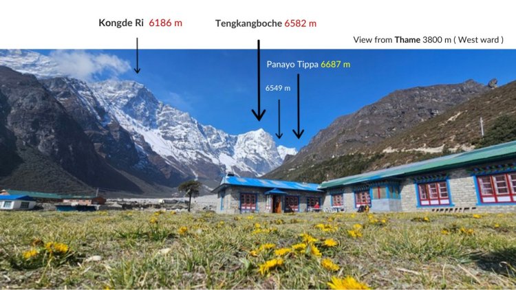
Next morning. The view towards WEST from guest house @ Thame 3800 m, the way we descended was another spectacular sight to behold !.
I could spot Rosy Pipit busy in the fields.
While walking down beside the river bed, in could see few Yaks grazing below the mountain slopes grazefully.A Monal Pheasant in colourful plumage in flight and resting on the rock.
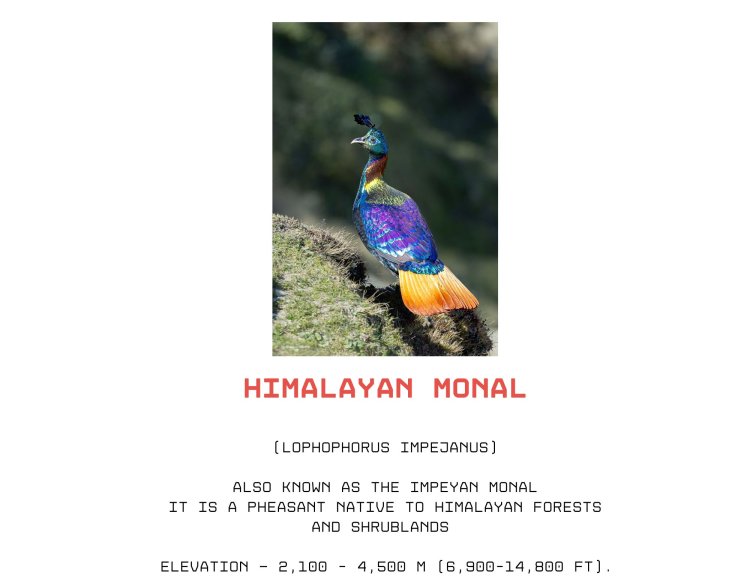
The national bird of Nepal is the Himalayan Monal (Lophophorus impejanus), commonly known in Nepali as the Danphe. It is a large pheasant that inhabits the Himalayan forests.
Before to approaching Thame i could see the outcome of the devastating flood which struck Thame, a village in the Khumbu region of Nepal, 16 August 2024 was due to an outburst flood from Thyanbo glacial lake.
It is reported that 7 homes had been destroyed, including one school, one health post, five hotels causing huge loss.
The view from Summit lodge is something cherish for a lifetime with views of Mountains in horizon and backdrop.
09 Day - Namche Bazaar
The journey from here to Everest trail passed through hanging bridges, deep valleys while spotting birds.The prayer wheels, chortens added to the beauty of the place. We could many trekkers enroute to Renjola Pass.
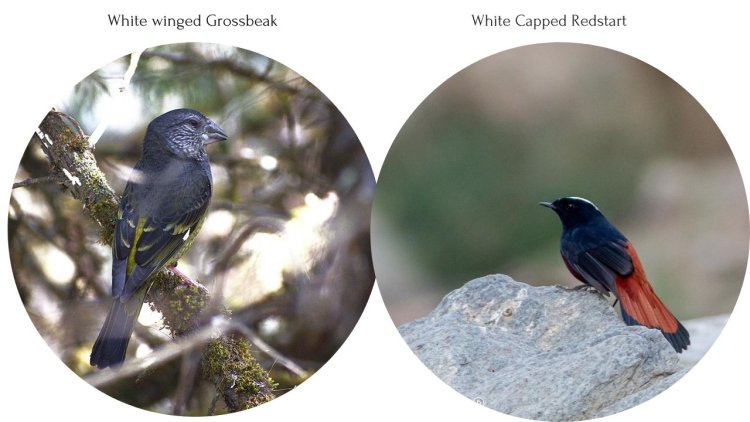
For me sighting birds was a pastime.They kept me engaged all time.A pit stop served as rest and appreicate the beauty of the place. A white beaked gross beak and White capped redstart drew my attention amidst bushes
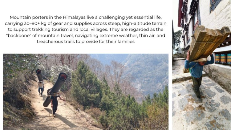
The hardship of porters to make every one comfortable and their pain to eke out a living is something to how harsh is the mountain dwellers life..Be anything to be carried they are at service. That is life and we need to care for their services and respect them.
10 Day - Phakding 2,610 m
Passing through Jorshalle, Tok Tok, and crossing bridges listening to the roaring river.I found this trail this time, more engaging and alluring. Instead of monotonous climb and journey to guest house to Guest house. I walked in a relaxed pace.
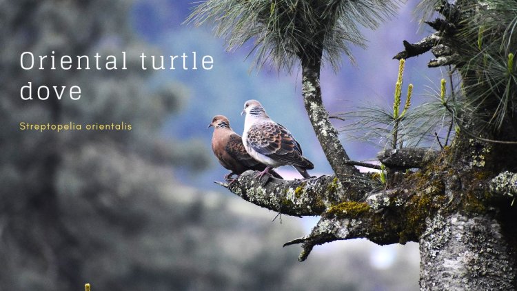
I could spot few Bharals, Long tailed Minivets, Streaked laughing thrush, Yellow billed blue magpie, Grey backed shrike, Blue whistling thrush, Plumbeous water redstart, Oriental turtle dove pair in a discussion,
11 Day - Lukla 2835 m
As usual we had decided to fly from Lukla to Kathmandu by STOL mountain flight.
The weather seemed clear in the morning, we had even reached the baggage counter.Suddenly the weather played a spoilsport and flights were CANCELLED.
We waited for few hours for weather to subside and finally decided to travel to Surke on the Jiri trail for 1.5 hours, followed by a steep descent along Rhododendron forest.
From there a overnight break at SALLERI, travelling through Offroad for about 20 hours we reached Kathmandu by evening.
The adventure was unlimited with a rickety journey.We thanked gods for being merciful on us all times.All the effort seemed worthwhile to make a dream turn into reality.
It reminded me of quote - "Getting to the top is optional. Getting down is mandatory." — Ed Viesturs
No shortcuts, no filters — just pure achievement, emotion, and unforgettable memories.
TASHI LAPCHA I TASHI LABSTA I TRASHI LABTSA I TESHI LACHE
1. It is a high altitude trek, 5755 m located in Rolwaling valley and requires proper planning and preparation.
2. Expereinced guide, staff, with all technical gear is Mandatory.
3. Medical Insurance cover is a MUST for all.
4.Gradual Height again.Proper Acclalitization is MANDATORY for all.
5.Reserve days are Necessary and are Mandatory. Duration 15 day Minimum 17 Days Max
6.Carry proper clothing,Goose Down jackets fill 800 down and waterproof boots, Sleeping bags 800 fill down, Dome type 3 season tents, Crampons, Seat Harness, and fixed ropes, Jummar, descender, Pittons are MUST.
7.Trekking Permits are Mandatory.GCAP ( Gowrishankar Conservation Area Permit & Sagarmatha National Park )
8. Diamox, I suggest taking a half tablet in the morning , starting on reaching altitude 2500 m. Hydrate yourself with water enriched with electrolytes.
9.Carry High altitude medicine and First aid
Thanks for taking time to brush through the blog.
If you have been on this trail earlier , we are eager to hear about your experience !
Please be free to leave a comment.
If you are a trekker and love to do the above trek, please let us know.We will be happy to assit you & plan for you all times.
For more details, write to us summitersadventures@gmail.com